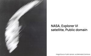
The first crude satellite image of the Earth was captured on August 14, 1959, by the U.S. Explorer 6 taken at an altitude of around 27,000 kms (17,000 mi) crossing over Mexico. It shows the sunlit area of the Central Pacific Ocean and its cloud cover . It was transmitted to a ground station in Hawaii during a 40-minute timeframe. Since, then, earth observation satellite imagery and image processing has grown multifold, both technologically and commercially.
Prior to this, ‘Aerial Photography’ was extensively used for earth observation research and applications. Eventually, satellite remote sensing evolved, allowing larger areas to be captured on a regular basis.
During these times, a few key advancements helped the earth observation satellite image processing:
- Usage of optical and non- optical sensors
- Local computing infrastructure: The computer age pushed the processing power limits and reduced the computer sizes from large rooms to micro computers.
- A transition from analog to digital imagery
Today, with the advancements in cloud computing, machine learning and artificial intelligence, edge computing or edge processing will be the next important milestone in the earth observation industry.
Comparing Conventional Processing and Edge Computing
The limitation associated with ground-based processing involves the steps of downlinking the data and then processing it. The conventional analog-to-digital signal conversion, coupled with data storage, transmission to a ground station, processing, and eventual generation of usable information, introduces a defined time delay of 12 to 48 hours. This temporal lag presents a notable challenge in achieving near-real-time analysis and results, warranting consideration for improvements in operational efficiency.
The image below demonstrates the comparison of conventional processing with edge computing for earth observation.
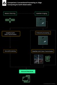
Edge computing is taking data processing to the source of data instead of centralized data center or cloud, in our case we are talking about satellites. What edge computing enables is increasing efficiency of information generation by controlling the data in motion while reducing the turnaround time for data processing and increasing the volume of useful data available for further processing for applications. Instead of the data transmission to work centers or cloud, the data computing happens on site.
The Advantages of Edge Computing for Earth Observation (EO)
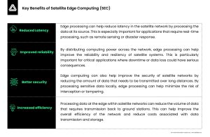
Edge Processing has several advantages that make them well-suited for handling the large amounts of data generated by EO sensors.
The First Company to Test Edge Computing in Space
KaleidEO, a SatSure company, became the first Indian company to demonstrate edge computing in space.
We successfully demonstrated deep learning based algorithms to analyze imagery in-orbit, as captured by Satellogic – a satellite constellation and data provider company based out of Montevideo, Uruguay. The hardware to run the algorithms and implementation support was provided by KaleidEO’s partner Spiral Blue, a startup based out of Sydney, Australia.
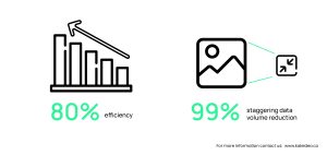
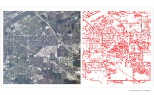 Our unique engineering pipeline showcased its capability to seamlessly manage diverse stages of image processing and data movement. The results demonstrated remarkable efficiency of 80 times faster, while achieving a staggering data volume reduction of approximately 99% between input and output (analysis-ready data), thus demonstrating potential of curtailing the downlink costs. The demo specifically employed sub-meter resolution imagery, a feat achieved by only a handful of companies globally due to the complexities associated with handling larger image sizes.
We are gearing up for aerial testing of our high-resolution, high-swath optical and multi-spectral payload whose success would lead to commencing manufacturing of the satellites and the payloads.
To know more about our work at KaleidEO in the upstream sector and how we aim to increase the value of information generated per bit, reach out to us at info@kaleideo.co or visit www.kaleideo.co.




Add comment